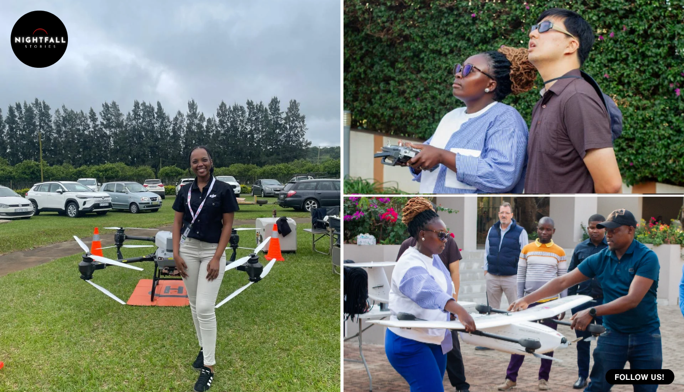
Kátia Manjate had never touched a drone in her life. A year or so later she was flying one over a river that had climbed halfway up the walls of people’s houses, looking for families stranded on roofs, and passing their positions to the men in the boats.
She was not supposed to be doing that yet. She was part of a training cohort, a group of Mozambican civil servants who had been pulled out of meteorology offices, road agencies, water management and the national disaster institute and taught, from nothing, how to fly and how to turn what the aircraft saw into usable maps. The course had a syllabus and a timetable and a graduation date. The Incomáti River did not consult any of them. When the water came, the class was roughly half finished, and it was deployed anyway.
What happened afterwards is the part that has travelled furthest, and it needs to be said carefully, because the version circulating online is not quite the version in the documents. In Marracuene, the district north of Mozambique’s capital where the river burst its banks and where the drones flew, not a single life was lost. That is remarkable and it is real. It is also specific to that district. Nationally, the same flooding killed 12 people and affected 692,522, according to the African Development Bank’s own account of the emergency, which also records more than 1,300 kilometres of road destroyed, over 100,000 hectares of farmland ruined, tens of thousands of livestock lost, and a school year pushed back because the schools were full of water.
The damage figures are worth reading slowly, because they describe a different kind of loss from the one a death toll measures. More than a hundred thousand hectares of farmland ruined is a year of income gone for households that do not have a second year of savings behind them. Tens of thousands of animals lost is the same thing in another form, since livestock in much of the region functions as a bank account with legs. The postponed school year meant hundreds of thousands of children starting late because the buildings were underwater or being used to shelter families. None of that appears in a casualty figure, and all of it is still being worked through.
So the honest headline is not that a country came through its worst flooding in decades without a death. It is that in the one district where a new piece of technology and a half-trained crew of local pilots were actually in the air, the water took nobody. Those are different claims, and the smaller one is the more interesting of the two, because it can be examined.
The flooding ran for most of a month at the start of this year, after weeks of rain that the ground had no capacity left to absorb. Marracuene sits on low, green, heavily farmed land where the Incomáti widens on its way to the sea, which is exactly the kind of place that floods and exactly the kind of place people farm anyway, because the same river that drowns the fields is the reason the fields are worth having. The district’s mayor, Ahmad Shafee Sidat, described watching all of that green vanish under water, with the flood standing higher than half the height of the houses.
This is not a new experience there. Mozambique’s coastal plains flood on a rhythm that everybody who lives on them understands, and the historical pattern is that the counting afterwards is a count of the dead. What was different this time was that somebody up above could see.
The project behind it had been running for less than a year when the river arrived. It was launched by Mozambique’s government together with the African Development Bank, financed through a trust fund built on South Korean money for African economic cooperation, with technical work from a Korean technology park. The equipment package was substantial: nine drone systems, four of them for training and five for operations, fitted with cameras and laser scanning instruments that measure distance and height, plus simulators, unmanned surface craft for working on water, and the data platforms needed to turn all of it into maps. A dedicated training centre opened a few months before the flood, and the plan covered five flood-prone zones of the country.
The funding route is unusual enough to be worth explaining, because it shapes the outcome. The money did not come as bilateral aid from one government to another. It came through a trust fund set up for economic cooperation between South Korea and African countries and administered by the African Development Bank, which means the design was made by a development institution rather than a donor ministry, and development institutions tend to be judged on whether a capability still exists in five years. That is a bureaucratic detail that turns out to explain the training-first structure entirely. An agency measured on delivery counts hands over drones. An agency measured on outcomes builds instructors.
It also explains why the equipment list includes things that look redundant at first glance. Four of the nine aircraft were designated for training rather than operations, which is a quarter of the budget spent on machines that were never meant to fly a real mission. Simulators were included as well. Somebody had clearly seen what happens when a fleet is bought without spares for the learning curve, and every aircraft is too precious to risk a beginner on.
The crucial design decision was made early and it is the reason this story exists. The money could have bought aircraft and handed them over, which is how a great deal of disaster technology arrives in a country and then quietly stops working when the first battery dies or the first software update breaks something. Instead the project was built around training Mozambicans to fly, to maintain, to process the imagery, and eventually to teach other Mozambicans. The hardware was the smaller half of it.
Manjate has described learning the full pipeline, not just the flying but everything from collecting the data to producing the finished product at the other end, which in practice means she can take an aircraft up, bring the imagery down, and hand a rescue coordinator something he can act on. That is a different skill set from operating a camera.
Another of the pilots, Hermelinda Nhamuche, spent the emergency mapping roads. It sounds like the least dramatic job in a flood and it is close to the most important one. When a plain goes under, the roads do not simply become wet. Some of them are gone, some are passable, some are passable only by a vehicle with clearance, and the difference between them is invisible from a boat or a truck cab. Rescue teams heading into flooded terrain without that information are guessing, and a guess that puts a truck into a washed-out section turns rescuers into people who need rescuing. Nhamuche’s maps fed straight into search and rescue planning.
The drones themselves were not doing anything exotic. They were flown low over the flooded area to find specific families on specific roofs, to establish where the water was deep and where it was shallow enough to drive, and to send live pictures back to the people making decisions. The laser instruments gave depth and elevation, so a route could be assessed rather than attempted. None of this is science. It is the ordinary, unglamorous business of knowing where people are before you go to get them, which is precisely the thing that has always been missing.
There is a detail that gets skipped in most accounts and deserves to be kept, which is that some of the drone operators had been ordinary office staff a year earlier. The cohort was drawn from public institutions, together with personnel from the security forces, and the emergency required them to work with Korean specialists flying alongside them while they were still learning. About twenty of them were operational when the flood began.
Preciosa Mondlane, described in reporting as someone who lived through the flooding herself, was among those who saw the aircraft overhead. It is worth being careful with that kind of testimony. A person on a roof watching a small machine circle above them cannot know whether it is the reason a boat arrives an hour later, and the reporting does not establish a chain between any single flight and any single rescue. What can be said is that the district’s coordinated response had eyes it did not have in previous floods, and that at the end of the emergency its casualty count was zero.
The mayor has credited the partnership directly for that outcome. It is his district and his judgement, and it carries weight, but it is a judgement rather than a measurement. Nobody can run the counterfactual. Floods vary, the warning came at a certain hour, the population moved at a certain speed, and disaster outcomes are always the product of a dozen things happening at once. The careful claim is that a district which historically loses people did not lose any in its worst flooding in decades, and that the most conspicuous new element in its response was a fleet of drones flown by local staff.
The national picture puts a necessary frame around it. Twelve people died elsewhere. Nearly 700,000 had their lives disrupted. Gaza Province, well to the north, took the heaviest damage, and the drone operations there began in the last days of the emergency, after coordination meetings, focused on districts along another flooded river. So the technology was not evenly present, the response was not uniform, and the country did not come through unharmed. It came through with one district that had something the others did not, which is the beginning of an argument rather than the end of one.
What happened next is the part that decides whether this was a lucky season or a working system. The cohort grew from the twenty who flew in the emergency to thirty trained specialists drawn from across the relevant agencies. By the middle of this year, all thirty had received national certification, and ten of them had been brought on further as instructors, meaning they are now licensed to train the next group themselves.
That number, ten, is the one worth watching. A trained pilot is an asset that decays: people move jobs, take other posts, leave the sector. A trained instructor is a multiplier, and ten of them inside the national system means the country can produce its own operators without a foreign technical partner in the room. It is the difference between having been given a capability and owning one. The project’s stated aim from the start was a skilled national workforce able to run disaster response with confidence and on its own authority, and the instructor certifications are the first hard evidence that the aim was not just language for a press release.
Mozambique is a reasonable place to test the idea, because it is one of the countries most exposed to climate-driven disaster on the continent. Its long coastline takes cyclones. Its river basins drain highlands in neighbouring countries, which means a flood can be generated by rain that never fell on Mozambican soil. The population lives disproportionately on the low, fertile, dangerous ground. Weather that used to be exceptional is arriving more often, and the country’s capacity to see what is happening in real time has not historically matched the frequency of what happens.
Drones do not fix any of that. They do not stop a river, protect a farm, or rebuild 1,300 kilometres of road. What they change is the quality of the first six hours, which is the window in which most preventable deaths in a flood occur. Knowing that there are four people on the roof of a particular house on a particular lane, and that a truck can reach within 300 metres of it by going the long way round, is worth more in that window than almost any amount of equipment arriving later.
For Manjate and Nhamuche, the story ended somewhere very different from where it started. They began as public servants with no aviation background whatever, enrolled in a course because their departments sent them. They finished it in the worst conditions the job is ever likely to offer, before they were qualified, with people on roofs below them. Now they hold national certification, and some of their classmates are the ones standing at the front of the room for the next intake.
There is a version of this story being shared online that says an entire country got through a historic flood without a single death. That version is not true, and the families of the twelve people who died deserve better than to be edited out of a good news headline. The true version is quieter and more useful. In one district, a group of people who had barely learned to fly were sent up early because the water would not wait, and everybody who lived there came out the other side. They are now teaching others how to do it.