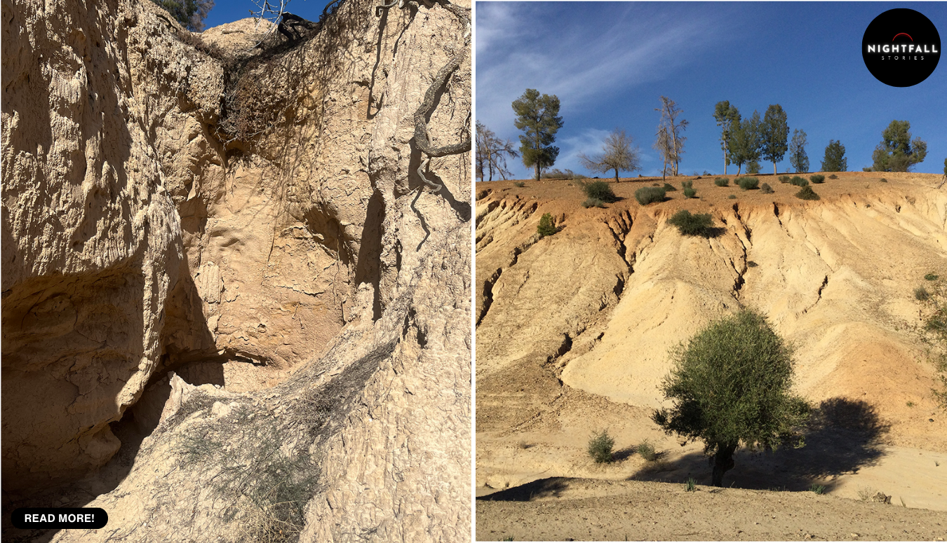
There is a ridge in northwestern Morocco with a line running across it. You can see it from the air and you can see it from the ground, a bank of earth and stone cutting off the southern approach to a spur of high land, the kind of feature that any walker would clock as man-made and then stop thinking about. It sits about a hundred kilometres inland from the Atlantic, in Khémisset province, above a village whose houses you can see in the background of the photographs the archaeologists have been taking.
An archaeologist named Armand Ruhlmann wrote it down in the 1930s. He even said what he thought it was, a prehistoric fortified spur, a settlement that had sealed itself off by walling across the neck of the ridge. And then, in his own words and everybody else’s afterwards, the dating of it was very uncertain.
So it sat there. For close to ninety years, the deep history of this part of the world was written without it. Not because anyone hid it or lost it or argued about it. Because nobody went back and asked the question. The wall was a known feature of a known place, sitting in the published record, and the simple follow-up of finding out when it was built did not get done until a few years ago.
When it finally did get done, it produced what the research team describes as the oldest defensive system known anywhere in North Africa outside the Nile Valley.
The site is called Oued Beht, and to understand why the wall matters you have to understand what the same team had already found underneath it. Because this is the second surprise at a place that had already delivered a big one.
Until recently, the standard account of North Africa in the fourth and third millennia BC was a blank with an apology attached. Egypt was a civilisation. The rest of the continent north of the Sahara was assumed to be thinly occupied, marginal, the edge of somebody else’s story, a place that received influences rather than generating them. Part of that assumption was genuinely about evidence, and part of it was about who had done the digging, which for most of the twentieth century meant a small number of European researchers working in a colonial frame with a limited set of questions.
Then the Oued Beht Archaeological Project, a joint effort between Morocco’s National Institute of Archaeological and Heritage Sciences, Italy’s National Research Council, the international association ISMEO and the University of Cambridge, started working the ridge systematically. The first big publication landed a couple of years ago, and it described a farming society dated to roughly 3400 to 2900 BC occupying nine or ten hectares of the ridge, which made it the largest agricultural settlement known from that period anywhere in Africa outside Egypt.
The detail in that report is what makes it feel like a real place rather than a data point. Surface survey across nearly twenty hectares recovered close to twenty thousand artefacts, sixteen thousand of them pottery. Some of that pottery was slipped and burnished, a small percentage painted dark on light. There were hundreds of grinding tools and dozens of polished stone axes, with evidence that they were being made on site rather than brought in. Sieving the fill of one pit produced domesticated barley, wheat and peas, alongside wild olives and pistachios. The animal bones were goat, sheep, cattle and pig, with butchery marks on them.
And there were the pits. Deep bell-shaped pits, cut into the ridge at something like one for every ten square metres of ground. That is an extraordinary density, and the most plausible reading of them is storage, most likely grain. Which means surplus. Which means a community producing more than it ate, holding it, and presumably having opinions about who got to open which pit.
The other thing that report argued was that this community was not isolated. The painted pottery and several of the tool types have real parallels in southern Iberia at the same period, across the strait. Not identical, not a copy, but the kind of resemblance that comes from two regions that knew about each other. The team’s framing was that this was a two-way relationship, not a periphery absorbing culture from a centre.
That was the first surprise. The second is the wall, and it arrives from a completely different era.
In the autumn of 2023, in the project’s third season, the team put trenches into Ruhlmann’s old feature and into the ground around it, and sent a drone up to photograph the whole spur from above. The excavation was not quick, the analysis took the best part of two years, and the results were published a few weeks ago in the journal Libyan Studies, open access, with more than twenty named authors and the project’s three co-directors, Giulio Lucarini, Cyprian Broodbank and Youssef Bokbot, among them.
What the trenches showed is that the line across the ridge is not one thing. It is several things stacked on top of each other, built at wildly different times, which is exactly why it had resisted an easy answer for ninety years and exactly why nobody could date it by looking at it.
The stonework you can see on the surface is the youngest part. That wall, the visible one, was built in the Islamic middle ages, somewhere around the eleventh to thirteenth centuries AD, along with a cemetery. People came back to this ridge two thousand years after the prehistoric settlement had gone, looked at the same natural bottleneck, and reached the same conclusion about where to build a barrier.
Underneath it is the part that rewrites the map. A broad ditch and an earthen embankment, with the remains of an earlier wall phase built of daub and stone, running across the southern approach to the spur. Radiocarbon dating on seeds and charcoal puts that construction in the early to middle second millennium BC. Roughly three and a half to four thousand years ago. The Bronze Age.
That is a period nobody had documented at Oued Beht at all. The site was known for its Final Neolithic farming phase and nothing else. The 2023 season produced around two dozen new radiocarbon dates, spanning four distinct periods of use on the ridge, and seventeen of those are the ones that carry the fortification argument. The team’s position is that the second millennium BC activity is now established beyond reasonable doubt at a place where it was not previously known to exist.
The trench that did most of the work went into the feature the team labels Wall B1, and what came out of it reads less like a wall and more like a biography. The excavators describe a complex accumulation of walling, embankment and cut features rather than a single structure, with an earlier phase built of daub and limestone sealed beneath a later stone build. The earlier phase is the one the Bronze Age dates attach to, landing in a bracket somewhere around the nineteenth to seventeenth centuries BC depending on which samples you weight. The later stone build sits on top of it and is not prehistoric at all.
There is a term for the shape of the thing, éperon barré, which translates roughly as barred spur and describes a settlement that uses a natural promontory for three of its sides and builds across the fourth. It is a form that turns up all over prehistoric Europe, because it is the obvious solution when the ground offers you most of a defence for free. Ruhlmann used exactly that term for Oued Beht in the 1930s. He had the right label and no way to test it, which is a fair summary of what a great deal of early twentieth century archaeology could and could not do.
The drone work matters more than it sounds. An oblique photograph from the air shows the barrier as a single continuous line across the neck of the spur in a way no ground-level view can, and a vertical one lets the team map the trenches, the earlier excavations and the run of the wall onto the same frame. The published figures show both, with the village of Aït Siberne behind the ridge in the oblique shot. Ninety years of uncertainty and part of the resolution came from being able to get twenty metres off the ground cheaply.
Which is why they are willing to make the claim they make: that a probable ditch, embankment and crowning wall of that date is the oldest documented defensive system in North Africa outside the Nile Valley.
It is worth being careful with that claim, and the team is careful with it too. It is a statement about the documented record, in a region that has been surveyed far less thoroughly than Europe or the Near East. Something older may well exist and simply has not been dug, or has been dug and never dated, which is precisely the failure this whole story is about. Read it as the strongest thing currently on the table rather than as a final ranking.
What makes it more than a trophy is the timing. In the second millennium BC, across the strait in southeastern Iberia, the society archaeologists call El Argar was doing something very specific. Fortified hilltop settlements, metalworking, a social order with visible ranks and unequal burials, running from roughly 2200 to 1550 BC. It is one of the best known Bronze Age cultures in western Europe.
And at the same time, on a ridge in Morocco, people were digging a ditch and throwing up an embankment to close off the only easy way into their settlement.
The team is careful not to turn that into a direct cause. Nobody is claiming Iberians came over and taught anyone to build a rampart. The honest version is more interesting anyway: two societies on either side of a narrow sea, in the same centuries, both deciding that their settlements needed defending. That suggests a shared set of pressures, or at least a shared set of anxieties, in a western Mediterranean that was clearly more connected and more crowded than the old story allowed.
Nobody knows what those pressures were. That is the open question the paper leaves standing, and it is open mostly because the archaeology of the Maghreb in the second millennium BC is so thin. You cannot say who the wall was built against when you have almost no other sites of the same date to compare it with. Raiding, competition over stored grain, pressure over grazing land, a shift in climate, an internal dispute about who controlled the pits. All plausible, none demonstrated.
What you can say is that somebody decided it was worth the labour. A ditch and bank across a ridge is a serious piece of communal work. It takes organisation, a reason, and enough people who agree on the reason to keep digging. Communities do not build that on a whim, and they do not build it in a landscape where nothing ever happens.
The sequence, once you lay it out, is the thing that stays with you. A large farming settlement on the ridge around 3400 to 2900 BC, storing grain in hundreds of pits, trading ideas with people across the water. Then a gap in the record. Then, a millennium or so later, people fortifying the same spur in the Bronze Age. Then another long silence. Then medieval communities coming back, building a stone wall on top of the old embankment and burying their dead nearby. Then a French archaeologist in the 1930s writing the feature down, correctly identifying what it probably was, and having no way to date it. Then nothing for ninety years.
Lucarini’s own summary of it is that the ridge kept its secret for nearly a century and that the discovery forces everyone to look at this landscape with fresh eyes, which is a mild way of saying that a lot of published assumptions about Bronze Age North Africa were built on an absence of evidence that turned out to be an absence of looking.
That is the part of this worth carrying away, and it is not really about Morocco. Archaeology has a bias toward the new: new site, new trench, new season, new announcement. The thing sitting in a 1930s report with an unresolved question attached to it does not generate funding or headlines, and the question quietly stops being asked. It becomes furniture. Ruhlmann was not wrong about this wall. He said what it probably was, said he could not prove when, and moved on, exactly as a careful researcher should. The failure came afterwards, in the decades where everyone read his report and nobody followed it up.
Oued Beht is now one of the more closely studied prehistoric sites in northwestern Africa, and the project is continuing. There will be more seasons, more dates, and probably more surprises, because the ridge has produced two already and there is no obvious reason to expect it has run out. The medieval phase alone is barely explored. The gap between the Neolithic settlement and the Bronze Age fortification is still a gap.
But the wall has an age now. It took drones, radiocarbon dating, a team from four countries and two field seasons of preparation to get it, and all of that was in service of a question anyone could have asked in 1936 and nobody did.