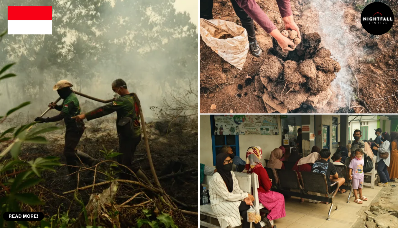
The fires making the news in Indonesia right now are the ones you can photograph. Orange light in the trees, helicopters with water buckets slung underneath, firefighters in yellow standing in a field of black stumps. Those are real, and they are bad, and they are not the ones that scientists are most worried about.
The worst fires there are underground. They burn down through metres of dried-out peat, moving slowly sideways through the soil like a cigarette working its way along a mattress, and they put out almost no flame at all. You can stand on ground that is on fire. You can drive past a landscape that is burning and see nothing except haze. Satellites built specifically to spot fire from orbit look down at these and, a lot of the time, register nothing, because they are trained to find heat at the surface and a peat fire does not give them a hot spot to find.
And once one starts, there is more or less no putting it out. Water goes onto the surface and the fire is not at the surface. Firebreaks stop a fire that travels above the ground and this one is travelling below it. The practical answer, the one the people who study this give without much softening, is that it burns until the rains come.
Right now the rains are not coming, and that is the whole crisis in one sentence.
A strong El Nino has settled over the Pacific, and it has been joined by a positive phase of the Indian Ocean Dipole, which is the equivalent weather pattern in the ocean to Indonesia’s west. Those two things together do something very specific to the region: they make the dry season drier and longer. Robert Field, a researcher at Columbia University who built the Global Fire Weather Database, has described the current fire activity as tracking sharply upward in a way that looks a lot like 2015, and has pointed at the El Nino as the reason the dry season is biting harder than usual.
In early August, roughly ninety percent of the country got little or no rain at all. On one day at the end of that month, satellites logged nearly a thousand active hotspots. By the first days of September, only about three weeks into the fire season, the fires had already released something in the region of ten percent of the total greenhouse gas emissions that came out of the entire catastrophic 2015 season. Three weeks in. Ten percent of a full disaster.
To understand why this particular kind of fire is so much worse than a normal forest fire, you have to know what peat actually is. It is not soil. It is thousands of years of dead plants that fell into waterlogged ground and never fully rotted, because the water kept the oxygen out. Layer on layer on layer, stacked up over millennia, in some places many metres deep. It is, functionally, an enormous underground store of carbon that has been sitting safely underwater since before recorded history.
Wet peat does not burn. Dry peat burns extremely well. It is essentially fuel, and it has been accumulating for a very long time.
Indonesia holds about thirty-six percent of the world’s tropical peatlands, concentrated across Kalimantan, Sumatra and Papua. That number alone tells you why what happens there is not a local story.
The thing that turns a safe carbon store into a fuel store is drainage. Through the 1990s, huge areas of peat swamp were cut through with canals to drain the water off, initially in an effort to convert the land to rice growing, later to make room for oil palm and other plantations. The rice project failed. The canals stayed. A drained peatland is a peatland with its fire protection removed, and in a dry year it becomes something you could not design better if you were trying to build a fire that cannot be extinguished.
So when a fire is lit at the surface, and most of them are lit deliberately as the cheapest way to clear land, it does not stay at the surface. It goes down.
It is worth being precise about why land gets burned, because the lazy version of this story blames whoever is holding the match and stops there. Fire is used to clear land because it is close to free. Machinery is not free. Labour is not free. Burning off a field costs a box of matches and an afternoon, and it also leaves behind ash that acts as fertiliser. That calculation is the same for a family with two hectares and for a company with twenty thousand, and it has been the same for a very long time. What changed was not the tool. What changed was the ground underneath it, when drainage turned wetland into something that catches.
The physics of what happens next has its own name. Smouldering combustion is fire without flame: a slow, oxygen-starved reaction that creeps through porous fuel at relatively low temperature and sustains itself for as long as there is dry material to work through. It is the same process that keeps a lit cigarette going in an ashtray with nobody drawing on it. Scale that up to a carbon deposit several metres deep and hundreds of square kilometres wide and you have a fire that can run for months, drop below the reach of anything poured on top of it, travel under a road and come up on the other side, and produce vastly more smoke per unit of fuel than open flame does, because incomplete burning is exactly what makes smoke.
That is where the measurement problem comes in, and the measurement problem is not a technicality. It is arguably the heart of the story.
Fire detection from space works by looking for thermal anomalies, patches of ground that are much hotter than they should be. The instruments doing that work over Indonesia include MODIS, on NASA’s Aqua satellite, and VIIRS, on newer platforms. Both are very good at what they were built to do. Neither was built for this. A smouldering peat fire under an intact forest canopy can be hot enough to be destroying an ancient carbon store and cool enough at the surface, and hidden enough beneath leaves, that the sensor passes over without flagging it.
Then there is the second layer of the problem, which is almost perverse. Mark Cochrane, an ecologist at the University of Maryland Center for Environmental Science, has made the point that the very worst smoke events are the hardest ones to see from orbit. The smoke is thick enough to block the satellite’s view of the fires producing it. The situation gets worse, and the data gets thinner, at exactly the same time.
Sit with that for a second. The official numbers, the hotspot counts, the burned-area figures, the emissions estimates, are all downstream of instruments that systematically lose sensitivity as conditions deteriorate. Which means the official numbers are close to certain to be an undercount, and the undercount is worst in the worst moments.
Shi Jun Wee, a graduate student at the University of Maryland, is working on the fix. Together with NASA and the MapBiomas mapping initiative, the project is building detection algorithms aimed specifically at fires burning under canopy, the ones the standard method misses. It is a good example of how unglamorous a lot of climate work actually is. No dramatic rescue, no new machine. Somebody sitting with satellite data trying to teach software to find a fire that does not look like a fire.
The reason it matters is that you cannot manage what you cannot count. A government cannot send crews to a fire it does not know exists. An emissions inventory that misses the underground component gives a country a cleaner-looking ledger than reality supports. And a peat fire that nobody has logged is one that gets to keep burning down through a carbon store for weeks without anybody deciding whether to intervene.
The emissions difference is not marginal. Compared with other tropical forest fires, peat fires have been found to produce roughly three times as much fine particulate matter, five times as much sulphur dioxide, three times as much organic carbon and about twice as much methane and carbon monoxide. Everything bad about smoke, multiplied.
Fine particulate matter is the number that reaches into people’s lungs. These are particles small enough to pass through the body’s filters and into the bloodstream, and they are the reason a peat fire hundreds of kilometres away is a medical problem rather than an inconvenience.
Across Sumatra, Kalimantan, Sulawesi, Java and Papua, that is what has been happening. The Indonesian health ministry has reported that around 3.4 million people are at risk of respiratory infection. Clinics in affected areas have described handling fifty to seventy patients a day with persistent coughs and raw throats. Pregnant women and young children are the groups flagged as most vulnerable, which is the usual and grim pattern with air pollution, because small bodies process more air relative to their size and developing lungs do not recover from insult as reliably as adult ones.
Millions of schoolchildren have been pushed onto remote learning. Nine national parks have closed. Flights have been delayed. In West Kalimantan, which has had some of the worst of it, residents have described conditions unlike anything in their living memory, with fire reaching the edges of everything they had.
The domestic detail that has stuck with people is the ash. One mother in an affected area described sweeping every single day and the ash simply returning, and her children being ill on and off for a month straight. That is what a peat fire season is at ground level. Not a wall of flame. A grey film on every surface, over and over, and a child who does not get better.
The volunteers fighting it have been open about the conditions. One described the situation as very serious and listed the problems plainly: not enough water, visibility ruined by haze, and shortages of the protective equipment and basic supplies crews need to work in smoke all day. The national government has moved, deploying dozens of helicopters and aircraft, water pumps and thousands of personnel, and distributing more than 260,000 face masks. A mask is a reasonable thing to hand someone. It is also an admission that the air itself is now the hazard and that nobody can switch it off.
The haze has not stayed inside the country’s borders, either. It has drifted across the region, which is what has made Indonesian fire seasons a recurring diplomatic problem for decades rather than a domestic one.
All of this has happened before, which is the part that makes 2026 feel less like an accident and more like a test.
1997 was catastrophic. 2015 was catastrophic. The 2015 season released around 1.75 billion tonnes of greenhouse gas equivalents and did an estimated 16.1 billion dollars of economic damage. A study by researchers at Harvard and Columbia estimated that the haze from that season was linked to roughly 100,300 premature deaths across the region, a figure that regional governments disputed at the time and which remains a modelled estimate rather than a body count, but which gives a sense of the scale at stake when the air over a populated region becomes unbreathable for weeks.
After 2015, Indonesia did act. There was a serious push into peatland restoration, and the centrepiece of it was blocking the canals, which is exactly the right instinct: if drainage is what made the peat flammable, then rewetting it is what makes it safe again. There was work on wetland restoration, on building firefighting capacity, and on preventing accidental ignitions. Some of it demonstrably worked. Peat restoration has been shown to reduce fire risk where it has been carried out properly.
The trouble is the scale of what had to be undone. Decades of canals cut across an area the size of a small country cannot be reversed in a decade, and rewetting peat is slow, expensive, politically awkward work that runs directly against the interests of whoever is farming the drained land. In the first half of 2026, before the season even properly started, around 100,000 hectares burned, and roughly half of that was peatland. That is the reform’s report card, and it is a mixed one. The system is better than it was. It is not better enough for an El Nino.
There is one more thing about peat fires that makes them different from almost every other disaster in the news, and it is the timescale.
When a normal forest burns, the carbon released came out of the atmosphere over the lifetime of those trees, decades, maybe a century or two, and the forest can pull some of it back in as it regrows. When peat burns, the carbon coming out went into the ground over thousands of years. It cannot be put back on any timescale that means anything to a person alive today. Peat accumulates at something on the order of a millimetre a year. A fire can take a metre of it in a season.
That is not damage. That is deletion.
So what happens next is, uncomfortably, out of anybody’s hands in the short term. The fires below the surface will keep going until the wet season arrives in force and the water table comes back up, and then most of them will stop, and the smoke will clear, and the flights will resume, and the children will go back to classrooms. The headlines will end. The canals will still be there.
The longer game is the one being played by people like Wee, sitting with satellite data trying to teach an algorithm to see a fire that gives off no visible flame, and by the restoration crews damming canals one at a time, and by the researchers who keep making the same point to anyone who will listen: the ground itself is the problem, and until the water goes back into it, every strong El Nino is going to do this again.
Somewhere under a stand of trees in Borneo right now there is ground that looks completely ordinary. No smoke, no light, nothing to photograph. A metre down, something laid there before any of this was a country is quietly going up, and it has been doing that for weeks, and nobody has written it down.